
MRT: Mogollon Rim Trail
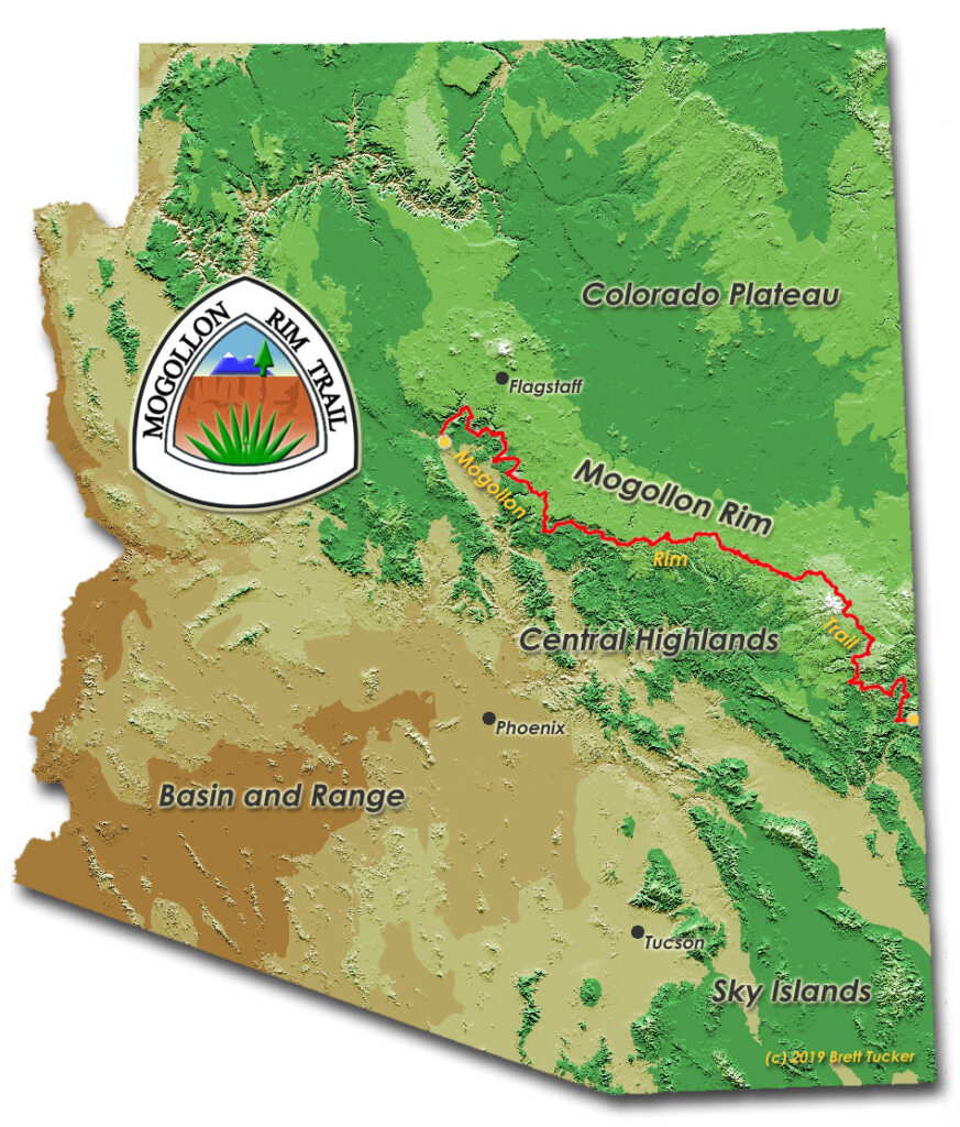
The Mogollon Rim is a topographical and geologic feature cutting across northern Arizona starting in Yavapai County and trending eastward., ending near the New Mexico border. The Rim also defines the southern edge of the Colorado Plateau. North of the uplifted sandstone and limestone escarpment is forest, canyon and lake country, while to the south, a transition to high desert.
The 500-mile Mogollon Rim Trail’s (MRT) western terminus is Sycamore Canyn near Cottonwood AZ. The MRT then points east through Redrock Country to Sedona, up through wild and scenic canyons, crossing the Arizona Trail near Pine AZ, climbs to the top of the Rim and continues eastward through the White Mountains, a land of forests, meadows, lakes and streams, and then finally on to the remote Blue Range where is ends just over the New Mexico border.
My trail towns and resupply points will be Sedona, Pine, Forest Lakes, Show Low, Greer and Alpine.
The MRT is a young, evolving route consisting of a combination of trails, dirt roads and cross-country travel and has been completed by only a handful of experienced hikers. If it has the challenge and adventure of the Grand Enchantment Trail and Hayduke Trail, I’m all in! Most critical on this trail is to have some miles under your belt, gear and navigation dialed in, and your pack weight down so not recommended for a first thru-hike. Probably not recommended for someone a year out from extensive ankle surgery but I’m working on that!