
Pacific Northwest Trail – 2026
Why the Pacific Northwest Trail (PNT)?
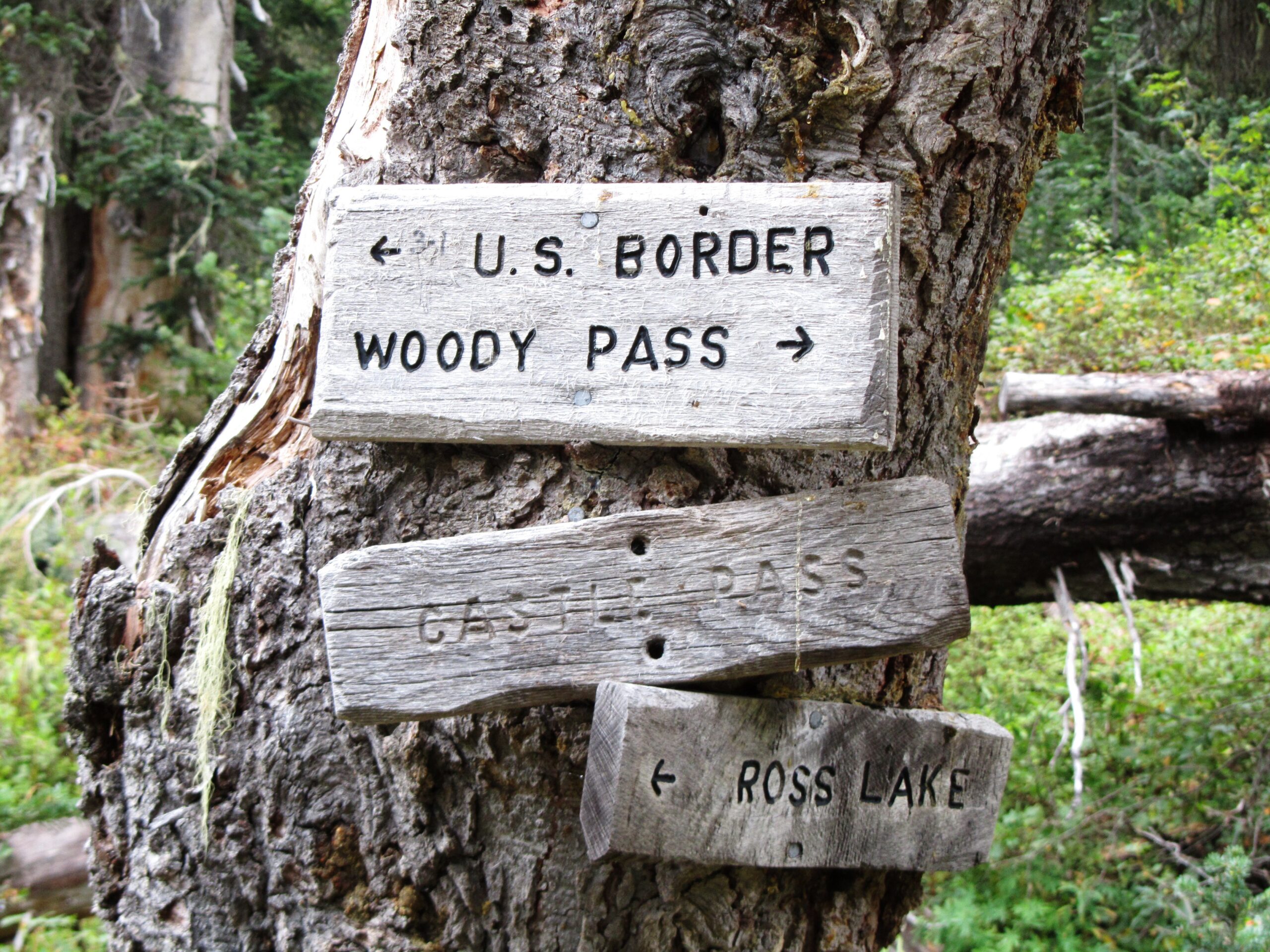
The Pacific Northwest Trail (PNT) has been on my shortlist for a long time. My first exposure to the PNT was crossing it’s path in 2013 for 13 miles on the Pacific Crest Trail (PCT) in Washington’s Pasayten Wilderness between Holman Pass and Castle Pass. I was only one day from finishing the PCT at the US/Canada border. My second meetup with the PNT was on my last day on the Continental Divide Trail (CDT) in 2017 in Glacier National Park along the Belly River and finish line at Chief Mountain on the US/Canada border. A lot of miles and trails since then but I never forgot my desire to hike this trail.
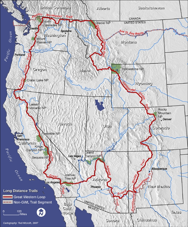
More recently, the secondary attraction for me is the last remaining “dots” and segments along the way to finish the Great Western Loop (GWL). The GWL, first completed by Andrew Skurka in 2007 (https://andrewskurka.com), is a nearly 7,000-mile route that connects six major trails in the western US, including the PCT, PNT, CDT, GET, AZT and the Desert Winter Thru-Hike (DWTH) I completed earlier this year. The only remaining piece for me is the Pacific Northwest Trail, connecting the CDT and PCT on the northern tip of the loop. I better get started before I get too old and feeble!
PNT- What and Where?
The Pacific Northwest Trail starts at the Canada/US border at Glacier National Park’s Chief Mountain and traverses along the border for nearly 1,200 miles through northern Montana, Idaho and Washington all the way to the Pacific Ocean and Olympic National Park at Cape Alava, the western most point of the United States. The journey travels through seven national forests, four wilderness areas, and three national parks. The trail cuts across the grain of several mountain ranges, along river valleys, lush high meadows and finally along the Pacific Ocean beaches. The PNT was designated a National Scenic Trail by Congress in 2009.
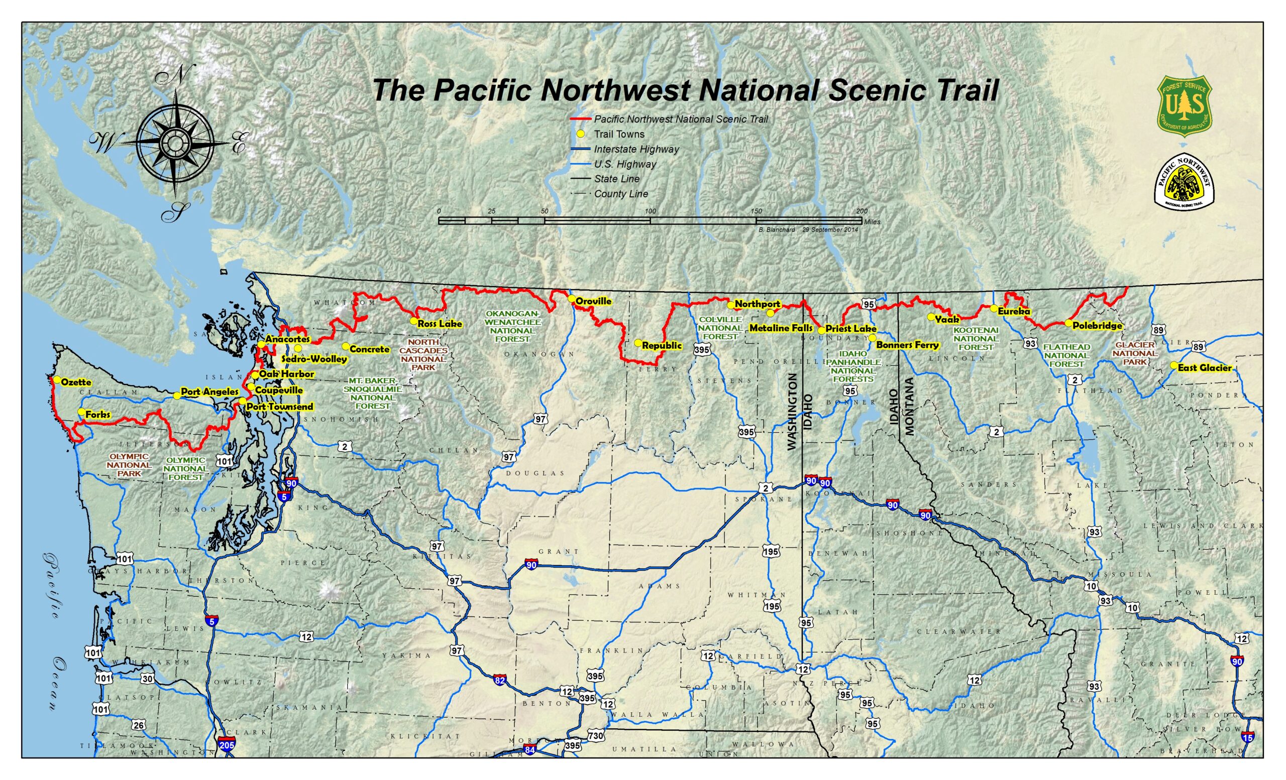
One of the main challenges of this trail is the vertical feet of elevation along the way, about 210,000 ft. Another challenge is the isolation in remote areas and the more difficult logistics support. Lastly, there is a small seasonal window if completing the trail as a thru-hike. And I almost forgot to mention that food prep/storage and situational awareness is critical because you are in black bear country nearly the whole trail and in grizzly country for about 400 miles.
But the best part will be the adventure, solitude and unmatched beauty of the Pacific Northwest!
The Pacific Northwest Trail Association has a great website with very useful information for planning a hike, including maps, www.pnt.org.
PNT Daily Posts
My daily blogs and other posts related to the PNT are found below: